

Squamish River valley, north of Squamish · Photo: Tim Gage, CC BY-SA 2.0
EDITORIAL · SQUAMISH RIVER FSR 9160 01 · MUD CREEK
The Squamish Valley road has been closed for most of 14 months. The NDP government hasn’t said who pays to reopen it.
A washout at Mud Creek has kept the Squamish River Forest Service Road, the only road into the upper Squamish and Elaho valleys, closed for most of the time since August 2025, and the Ministry of Forests now posts no access until spring or summer 2027. The ministry holds the road and says an unnamed “designated road maintainer” does the repairs, while the 25-year licence it signed in 2021, giving the Squamish Nation’s forestry company the valley’s exclusive logging rights, says nothing about the road.
On the night of 6 August 2025, rain washed out the Squamish River Forest Service Road where it crosses Mud Creek, about 21 kilometres up the valley from the end of the pavement. The next day the Ministry of Forests closed the road there “until further notice.” The Squamish Chief reported that it was unknown how many people were camped on the far side.0102
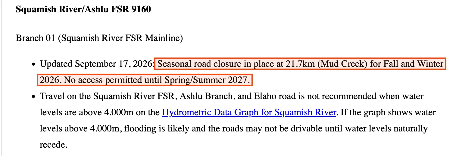
Fourteen months later the road is closed at the same creek. On 17 September 2026 the ministry’s Sea to Sky district posted a seasonal closure at kilometre 21.7, with “No access permitted until Spring/Summer 2027.” The recreation sites, the Elaho mainline and the park at the head of the valley all lie beyond that point.03
The road belongs to the Province. Its tenure record names the district manager of the Sea to Sky Natural Resource District as the holder of forest service road file 9160, section 01, which is 27.6 kilometres long. The forest it runs through is held under a different instrument. In 2021 the Province replaced Tree Farm Licence 38 with a new licence for 25 years, granting Northwest Squamish Forestry, a partnership wholly owned by the Squamish Nation, “the exclusive right to harvest” Crown timber across about 177,380 hectares of the Squamish, Elaho, Ashlu and Sims watersheds. Who reopens the road, who pays for it, and who keeps it open for the public are questions the Province has not answered in public.04050607
The Province holds the road and wrote the licence for the forest around it. It has not said who will pay to put the crossing back.
Beyond Mud Creek, the public has lost its road to two recreation sites, the Elaho Valley and a roadless provincial park.
The closure is at kilometre 21.7. Everything below is reached only by the road past that point.03
- Recreation sitesRecreation Sites and Trails BC
- The Squamish-Elaho Recreation Site, near the end of the forest service road, has been closed since 28 August 2026, with “No vehicle traffic … permitted beyond the closure point.” The Hideaway site lies just before it, and the Molson Memorial day site is farther up the Elaho.08
- The Elaho ValleyRoad permit R09478
- At the end of the forest service road, the 41.7-kilometre Elaho mainline continues north. It is a road permit road held by Northwest Squamish Forestry, so the only way onto it is past Mud Creek.04
- Clendinning ParkBC Parks
- BC Parks calls Clendinning an “undeveloped, roadless watershed” for wilderness recreation, permits hunting in open season, and sends visitors in on the Squamish forest service road.09
- IndustryThe 2025 crossing
- When the Nation’s forestry company put in a temporary crossing two weeks after the 2025 washout, the Nation said it was “for the use of industrial and commercial users.”10
The Minister of Forests, his Sea to Sky district and the licence holder each have a part in the road, and only the district’s part is written down in public.
- Ravi ParmarMinister of Forests, BC NDP
- He has been the minister responsible for the Ministry of Forests throughout the closure. His ministry holds the forest service road and decides who maintains it.11 FOR.Minister@gov.bc.ca
- Sea to Sky Natural Resource DistrictMinistry of Forests district office
- Its district manager is the road’s tenure holder, posts its closures, and under the district’s own rules names a single “designated maintainer” for each section of forest service road.1203 FOR.SeaToSky@gov.bc.ca
- Northwest Squamish ForestryHolder of Tree Farm Licence 38
- The partnership holds the exclusive harvesting right and, operating as Sqomish Forestry, built the 2025 temporary crossing. Whether it is the designated maintainer for this section is set in a road use permit schedule that is not published.051012
Section 01The Squamish River Forest Service Road is the only road into the upper valley, and the Province’s own record names the Ministry of Forests as its holder.
The Squamish Valley Road leaves Highway 99 north of Squamish as a paved road maintained by the Ministry of Transportation. Where the pavement ends, the gravel forest service road begins. The tenure layer lists it as file 9160, section 01, “SQUAMISH RIVER,” a Forest Service Road with the status ACTIVE and the client “DISTRICT MANAGER SQUAMISH (DSQ).” There is no licensee named on it. The Ashlu branch, section 02, leaves it near the start, and the district lists that branch as having “No access beyond bridge at 7km. No anticipated repair date.”0403
Here is the valley drawn from the Province’s own data: the tree farm licence boundary, the forest service road, the closure point, the Elaho mainline and the recreation sites. Read it for one thing, which is how much of the valley lies beyond Mud Creek.0408
The Squamish River Forest Service Road, the closure at Mud Creek, and Tree Farm Licence 38
The road line is section 01 of file 9160, 27.62 km in the Province’s tenure layer. The closure is drawn at kilometre 21.7, where the district’s notice places it, measured along the mapped line from its south end. The shaded area is the boundary of Tree Farm Licence 38 in the Province’s tree farm licence layer; the Elaho mainline is road permit R09478; the recreation sites are Recreation Sites and Trails BC’s own points.04030608
The Elaho mainline, the Hideaway and Squamish-Elaho recreation sites and Clendinning Park are all upstream of the closure. Recreation Sites and Trails BC posted the Squamish-Elaho site closed on 28 August 2026, the day the district posted the road closed, and BC Parks still directs Clendinning’s visitors up this road.0809
Section 02The ministry has posted the road closed at Mud Creek for most of the fourteen months since August 2025, and now says there is no access until spring or summer 2027.
The district publishes closures in one place, its road conditions page. Read in the order it was written, that page, the Nation’s notice and the recreation site record make a short history.03
- 7 Aug 2025
“Squamish River FSR closed at 21km until further notice due to washout at Mud Creek.”01
- 20–21 Aug 2025
Sqomish Forestry installs a temporary crossing “for the use of industrial and commercial users,” and the Nation says there is “no guaranteed access for any period of time.”10
- 5 Sep 2025
“Squamish River FSR closed at 21km (Mud Creek).” By December the entry reads “Road closed for the winter.”13
- Feb–Jun 2026
Every archived copy, the last on 10 June, reads “Road closed at 21km (Mud Creek) due to washout.”13
- 21 Jun 2026
Road users report the Mud Creek blockade removed. We found no official notice of a reopening.14
- 28 Aug 2026
A new washout. The district posts “No access permitted,” and the Squamish-Elaho recreation site is closed.1508
- 17 Sep 2026
“Seasonal road closure in place at 21.7km (Mud Creek) for Fall and Winter 2026. No access permitted until Spring/Summer 2027.”03
This is the entry as it stands today. It gives no date, names no work and says nothing about who will do it.03
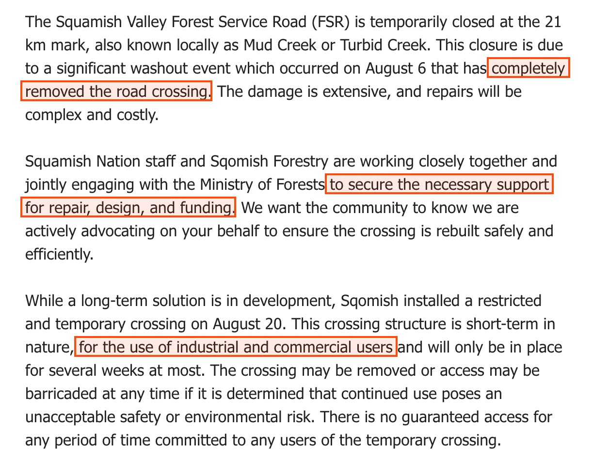
After the 2025 washout the clearest account of the damage came not from the ministry but from the Squamish Nation, whose forestry company works the valley. Its notice described the crossing as gone and said the Nation and its company were asking the ministry for help to pay for a new one.10
The archived copies of the ministry’s page show the September 2025 closure entry until at least 10 June 2026. Road users reported the blockade at Mud Creek removed on 21 June, and we found no official notice of the reopening. On 28 August 2026 the creek washed the road out again, and the ministry said repairs were “planned to begin early to mid-September, once rainfall subsides.” Three weeks later it posted the closure that now runs to 2027.13141503
Section 03Mount Cayley has been sending debris across this crossing for decades, and in 2013 the ministry’s own consultant found that no landslide record was kept.
Turbid Creek, which locals call Mud Creek, drains the south-west slope of Mount Cayley, an old volcano above the valley. In June 1984 a rockslide and debris flow off the mountain “removed the logging road bridge and road approaches at the mouth of Turbid Creek.” The crossing has failed many times since. In June 2014 about 350 people were stranded on the far side, and in September 2024 more than 20 vehicles were.16171819
In 2013 Pierre Friele, a professional geoscientist with Cordilleran Geoscience in Squamish, wrote a report for the ministry setting warning thresholds for the crossing. The ministry still posts his report on the district’s road page. He wrote that the road is “frequently washed out” there, and he described how the ministry kept track of it.16
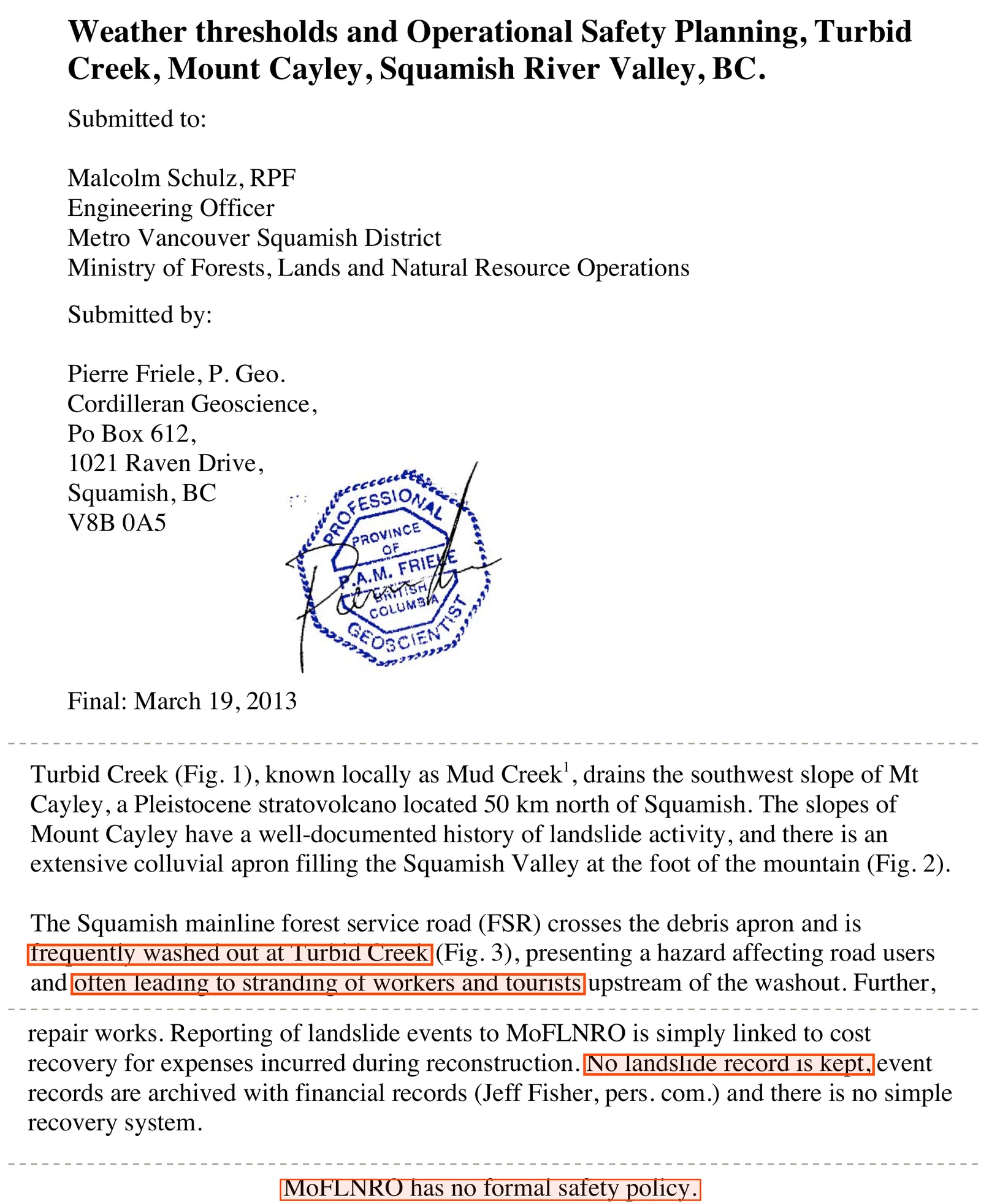
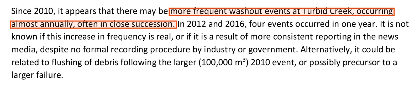
He also warned of what repeated closures do. “If the Squamish River FSR is closed too often,” he wrote, “the public and industrial users will likely ignore the closures.” Five years later a hazard study for the Squamish-Lillooet Regional District counted the events again and found that the washouts may have become more frequent.1620
None of the documents we read blames logging or road building for the washouts at Mud Creek. They put them down to the mountain’s “weak rock” and to rain, and in August 2025 the ministry said the washout “was created by a rain event.” In 2024 the ministry told The Squamish Chief the crossing “is prone to debris torrents” from the mountain and that “We continue to explore permanent solutions to this issue within the difficult terrain.” Two years on, it has published none.160219
The crossing has been washing out since at least 1984. In 2024 the ministry said it was exploring a permanent solution, and in 2026 it posted a closure until 2027.
Section 04In 2021 the Province gave the valley’s exclusive logging rights to the Squamish Nation’s company for another 25 years, and the licence is silent on who keeps the road open for the public.
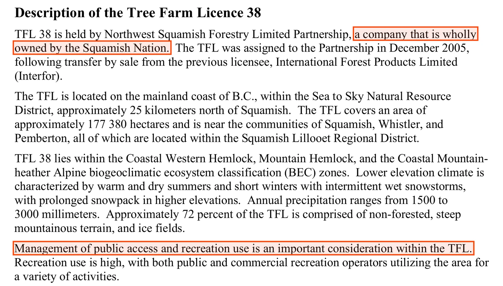
Tree Farm Licence 38 covers the Squamish, Elaho, Ashlu and Sims watersheds. Interfor held it until 22 December 2005, when it was transferred to Northwest Squamish Forestry; Pique reported the price as $6.5 million. The chief forester’s office describes the holder as a partnership “wholly owned by the Squamish Nation.”0706
In June 2021 the Province replaced the licence under section 36 of the Forest Act. The new licence was made by the Ministry of Forests, Lands, Natural Resource Operations and Rural Development, then led by NDP minister Katrine Conroy, and it runs for 25 years from 2 June 2021.0521
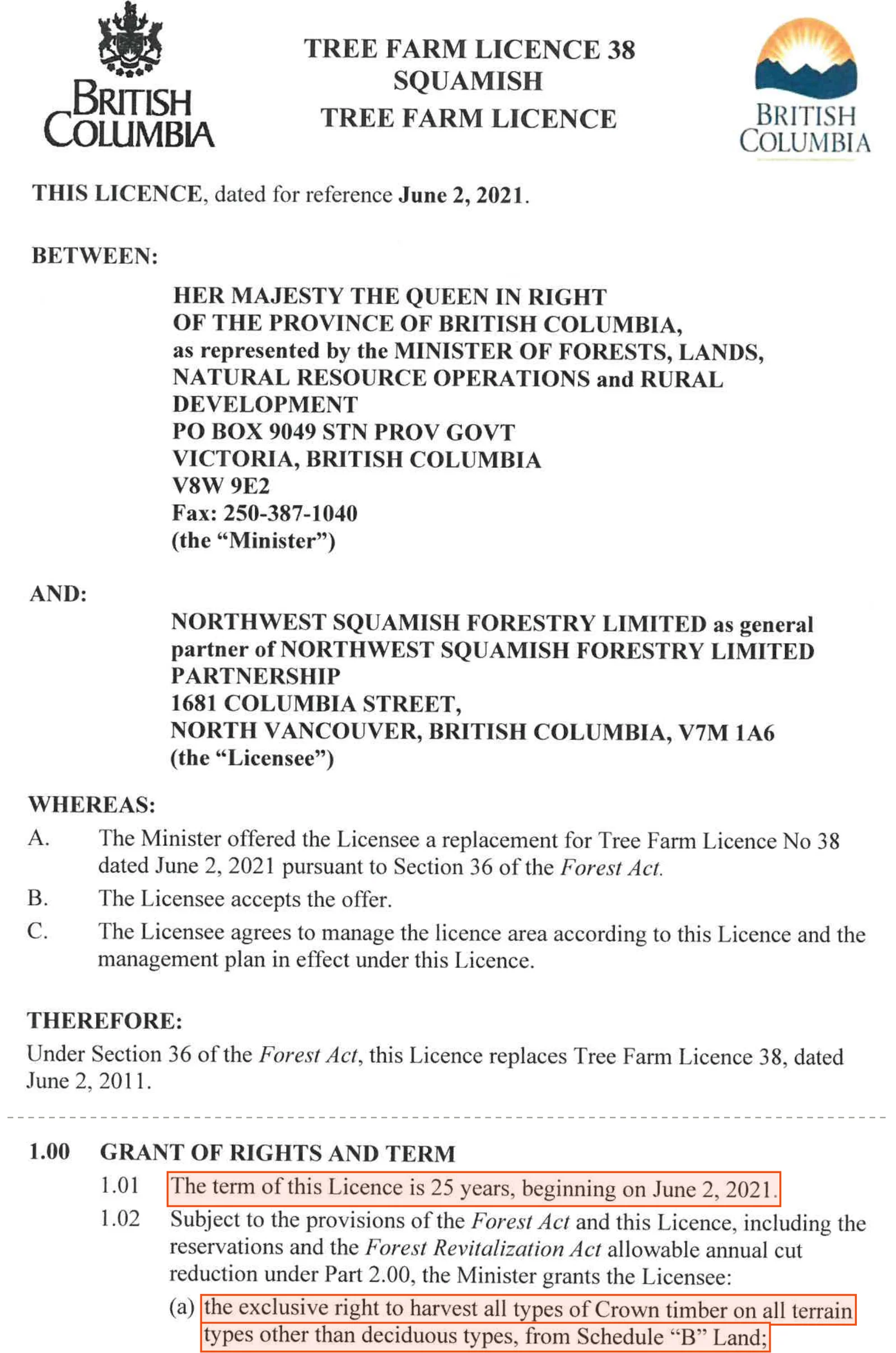
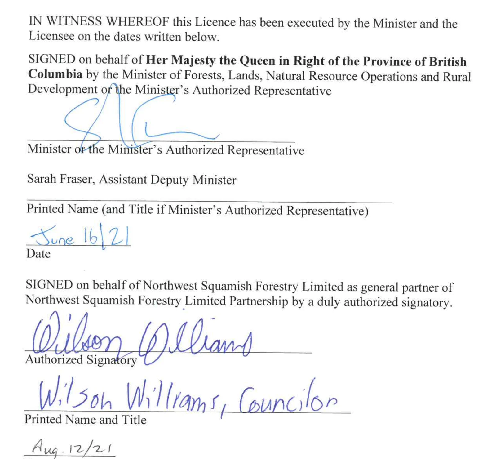
The licence was signed for the minister by an official, Assistant Deputy Minister Sarah Fraser, on 16 June 2021. Wilson Williams, a Squamish Nation councillor, signed for the partnership that August.05
Three years later the deputy chief forester, Albert Nussbaum, cut the licence’s allowable annual cut by about 53 percent, to 117,500 cubic metres a year. The Nation welcomed the cut. “This 53% reduction from the previous AAC is an important step toward restoring a healthy ecosystem in our territory,” said Wilson Williams, its spokesperson. The same rationale names public access as an issue in the licence area.0622
On access the licence itself says one thing, in one sentence, under the heading “Access and Accommodation.”05
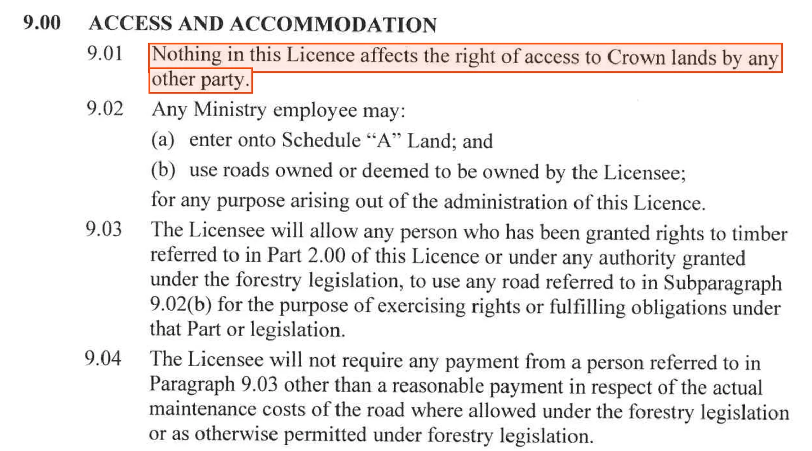
In our view that is the gap at the centre of this story. The Province handed one holder the exclusive right to log a valley for a quarter of a century, wrote in that the public’s access is unaffected, and said nothing about the only road the public uses to exercise it. The road stayed with the ministry, and so did the question of who keeps it open.
Four years later the Province and the Nation signed a land use planning agreement for the Nation’s territory, announced by the Ministry of Forests in June 2025. Its signature blocks name Minister of Forests Ravi Parmar and Minister of Water, Land and Resource Stewardship Randene Neill. It sets out 33 cultural sites and six special management areas, and its road terms cover roads inside those areas. It does not mention the Squamish River Forest Service Road.23
Section 05The ministry leaves the repair to a “designated road maintainer” it has not named, and its own rules set the standard at safe industrial use.
When the crossing went out in 2025, the ministry told The Squamish Chief that “plans are being made by the designated road maintainer to complete repairs” and that “There is no completion date known at this time.” It did not say who the designated maintainer was.02
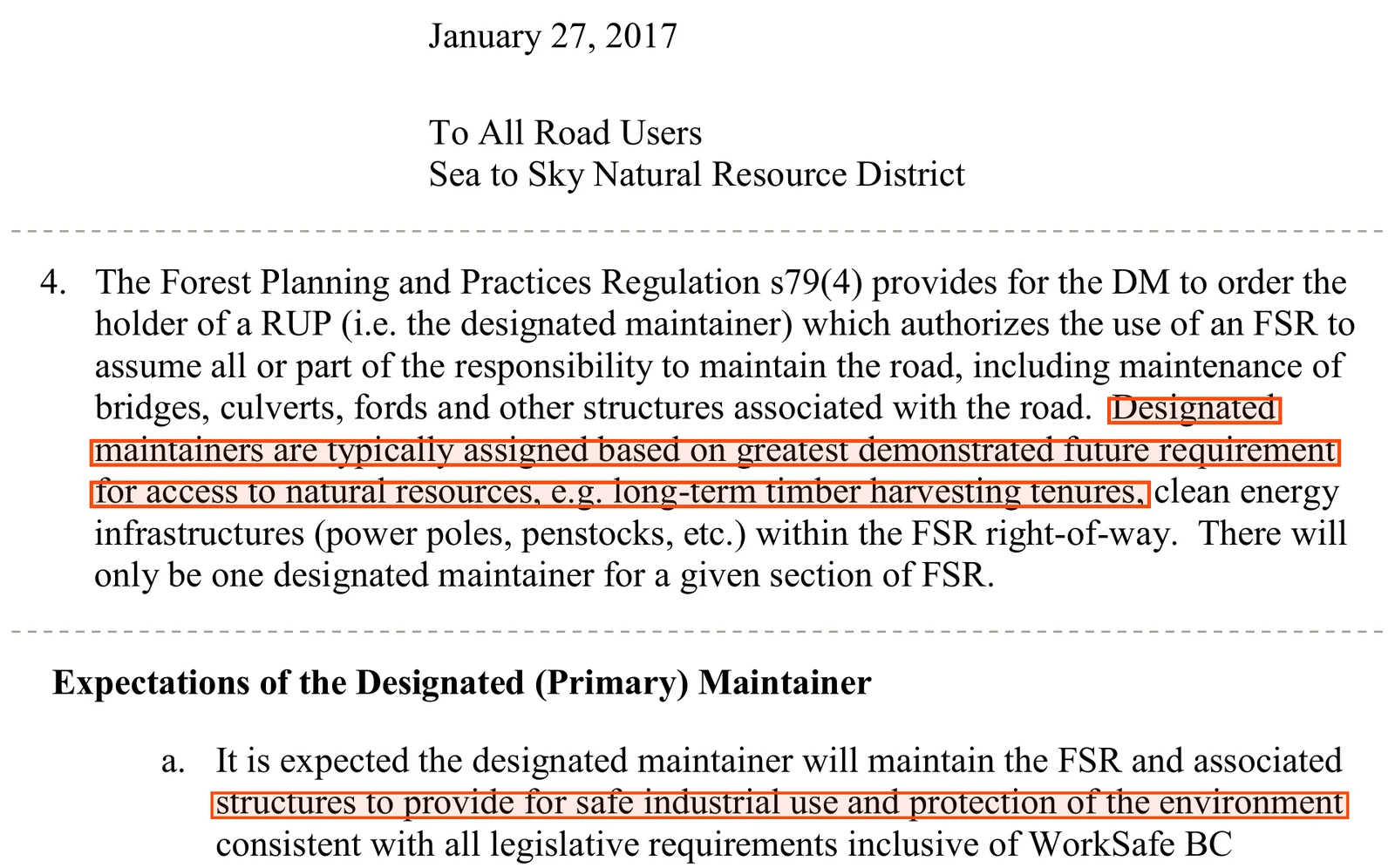
The district’s own letter to road users explains the term. A district manager can order one road use permit holder to take on the maintenance of a section of forest service road. That holder is usually the one with the biggest long-term need for the road, such as a timber licence. The letter also sets the standard the maintainer is held to.12
The Forest Practices Board said the same in 2011, in an investigation that covered the Squamish district. “Forest roads are designed, built and maintained for safe use by industrial traffic,” it wrote, which “does not always correspond to what might be expected for roads designed, built and maintained for general public use.” When industry stops using a road, the board found, it is “only maintained to address environmental concerns.”24
The name of the designated maintainer is written in the schedule of each road use permit, and those schedules are not published. The exclusive licence makes the Nation’s forestry company the valley’s main timber user, and that company built the 2025 stopgap. But the ministry has not said publicly whether that company is the maintainer, whether it agreed to the Nation’s request for repair funding, or what the 2025 and 2026 repairs cost.121002
In our view, that leaves the public with a provincial road whose reopening depends on what industry needs. The ministry holds the road, sets the standard, chooses the maintainer and posts the closures. It should say who is paying to put the crossing back, and whether the public’s use of the road counts for anything when it decides.
Section 06Forests Minister Ravi Parmar answers for the road, and no one raised it in the legislature after the washout.
Ravi Parmar has been the NDP’s Minister of Forests for the whole of the closure. We read every House and committee transcript from the first sitting after the washout, on 6 October 2025, to 28 May 2026. In 114 issues there is no mention of Mud Creek, Turbid Creek, the Squamish River road, the Elaho or Tree Farm Licence 38.1125
In March 2026 the minister told the Forests estimates committee who decides a closure, and warned that the ministry faces choices about which roads it keeps.26

“An FSR closure is made by the statutory decision–maker. That’s the engineer. Safety drives that.”
 Ravi Parmar · Minister of Forests · Hansard, Issue 141, 12 March 2026
“…some hard choices that will need to be made about which roads continue to be maintained as well.”
Ravi Parmar · Minister of Forests · Hansard, Issue 141, 12 March 2026The valley is in West Vancouver-Sea to Sky, where voting day is scheduled for 24 October. Its MLA, Jeremy Valeriote of the BC Greens, raised the Squamish Valley in the Environment and Parks estimates of April 2025, four months before the washout.27

“In the Squamish Valley, however, overtourism has threatened the peaceful enjoyment of the Squamish Nation’s members’ territory.”
 Jeremy Valeriote · MLA, West Vancouver-Sea to Sky · Hansard, Issue 38, 9 April 2025
Four candidates are on the ballot. We read their published answers to the local papers, their launch statements and their party pages, and found no public statement from any of them on the road, the closure or the licence.28

On the Squamish Valley roadNo public statement found.

On the Squamish Valley roadNo public statement found.

On the Squamish Valley roadNo public statement found.

On the Squamish Valley roadNo public statement found.
The people who use the valley have said more. Monika Bittel, recreation and access chair of the Federation of Mountain Clubs of BC, named the Sea to Sky this July as one place where losing roads pushes everyone elsewhere. “When people lose access, everybody is being forced into the places that remain open,” she said.29
Section 07Ask the Forests ministry who will reopen the Squamish Valley road, who will pay for it, and what the permanent fix is.
The ministry holds the answers to all four of these questions.
Who is the designated maintainer for the Squamish River Forest Service Road, and will the ministry publish the order?The ministry says that maintainer makes the repairs. The public should know who it is.
Who is paying to rebuild the Mud Creek crossing, and what have the 2025 and 2026 repairs cost?The Nation asked the ministry for repair, design and funding support in August 2025. The ministry has not said what it decided.
What is the permanent fix, and when will the design and schedule be published?The ministry said in 2024 that it was exploring permanent solutions. The road is now posted closed into 2027.
Will the road be open to the public whenever it is open to industry?The 2025 stopgap crossing was for industrial and commercial users. The tree farm licence says the public’s right of access is unaffected.
The letter linked below puts those four questions to the Minister of Forests and the Sea to Sky district office. It opens in your own mail app and sends from your own address. If you live in West Vancouver-Sea to Sky, put the same questions to the four candidates before 24 October.28
If you hold records about the road, such as notices, photographs of the crossing, correspondence with the district or a club’s figures on its use, send what you have the right to share to contact@backcountry.cx. Say where each item came from.
One night of rain took out the crossing at Mud Creek. The Province has had fourteen months to say who will put it back.
Share this story
Six images that carry the Squamish Valley road story on their own — the closure, the crossing’s record, the licence and who answers for the road. Made to be posted. Background photograph: Squamish River Valley by Tim Gage, CC BY-SA 2.0, via Wikimedia Commons, cropped.


Slide 1 of 6
Suggested caption
The Squamish Valley road has been closed for most of 14 months. The NDP government hasn’t said who pays to reopen it.
The Squamish River Forest Service Road is the only road into the upper Squamish and Elaho valleys. The Province’s tenure record names the Ministry of Forests’ Sea to Sky district manager as its holder.
On 6 August 2025 a washout took out the crossing at Mud Creek, about 21 km up. The ministry closed the road the next day, and its page showed it closed into June 2026. It washed out again on 28 August 2026. The ministry now posts: “No access permitted until Spring/Summer 2027.”
This crossing has failed for decades. In 2013 the ministry’s own consultant wrote that “No landslide record is kept.” In 2024 the ministry said it was exploring “permanent solutions.”
In 2021 the Province replaced Tree Farm Licence 38 for 25 years, giving Northwest Squamish Forestry, wholly owned by the Squamish Nation, “the exclusive right to harvest” the valley’s Crown timber. The licence says nothing in it affects the public’s right of access. It says nothing about the road.
The ministry says a “designated road maintainer” makes the repairs, kept to a standard of “safe industrial use.” It has not said who that is or who pays.
Ask Forests Minister Ravi Parmar who will reopen the road and who will pay. Full story and the letter: backcountry.cx/editorials/squamish-valley-road
Sources
- ↩↩Ministry of Forests, Forest Service Road Conditions in the Sea to Sky District, as archived on 11 August 2025. Squamish River FSR entry: “August 7, 2025: Squamish River FSR closed at 21km until further notice due to washout at Mud Creek.” File road/wayback-20250811182158_bcgov_road-conditions-sea-to-sky.html. https://web.archive.org/web/20250811182158/https://www2.gov.bc.ca/gov/content/industry/natural-resource-use/resource-roads/local-road-safety-information/sea-to-sky-natural-resource-district-road-safety-information/road-conditions-in-sea-to-sky-district
- ↩↩↩↩The Squamish Chief, Jennifer Thuncher, rolling road-conditions article (“Driving Sea to Sky”), as archived on 8 August 2025. “The Ministry of Forests tells The Squamish Chief that the washout was created by a rain event on the night of Aug. 6. The road was closed on Aug. 7. According to the ministry, safety assessments are taking place, and plans are being made by the designated road maintainer to complete repairs. There is no completion date known at this time. It is unknown how many recreationalists are on the other side of the closure.” The live page is behind a browser check; the archived copy was read. https://web.archive.org/web/20250808225841/https://www.squamishchief.com/local-news/updated-driving-sea-to-skysquamish-valley-road-washed-out-at-mud-creek-10487467
- ↩↩↩↩↩↩↩↩↩↩Ministry of Forests, Forest Service Road Conditions in the Sea to Sky District, as served 20 October 2026; the page reads “Last updated on October 19, 2026.” Under “Squamish River/Ashlu FSR 9160, Branch 01 (Squamish River FSR Mainline)”: “Updated September 17, 2026: Seasonal road closure in place at 21.7km (Mud Creek) for Fall and Winter 2026. No access permitted until Spring/Summer 2027.” Under Branch 02 (Ashlu): “No access beyond bridge at 7km. No anticipated repair date.” District contact: FOR.SeaToSky@gov.bc.ca. https://www2.gov.bc.ca/gov/content/industry/natural-resource-use/resource-roads/local-road-safety-information/sea-to-sky-natural-resource-district-road-safety-information/road-conditions-in-sea-to-sky-district
- ↩↩↩↩↩The road tenure record — WHSE_FOREST_TENURE.FTEN_ROAD_SECTION_LINES_SVW, forest file 9160, queried 20 October 2026. Section 01, “SQUAMISH RIVER,” file type Forest Service Road, status ACTIVE, 27.62 km, Sea to Sky Natural Resource District, client “DISTRICT MANAGER SQUAMISH (DSQ).” Section 02, “ASHLU RIVER,” 15.44 km, same client. The same layer lists road permit R09478, a 41.71 km Elaho mainline held by NORTHWEST SQUAMISH FORESTRY LTD. The Ministry of Transportation’s road inventory carries the paved Squamish Valley Road to the point where the forest service road begins. https://catalogue.data.gov.bc.ca/dataset/forest-tenure-road-section-lines
- ↩↩↩↩↩↩↩↩Tree Farm Licence 38, the replacement licence “dated for reference June 2, 2021,” with the licensee’s covering letter of 17 August 2021. Between the Province, “as represented by the Minister of Forests, Lands, Natural Resource Operations and Rural Development,” and “Northwest Squamish Forestry Limited as general partner of Northwest Squamish Forestry Limited Partnership.” 1.01: “The term of this Licence is 25 years, beginning on June 2, 2021.” 1.02(a): “the exclusive right to harvest all types of Crown timber on all terrain types other than deciduous types, from Schedule ‘B’ Land.” 2.02(a) reserves 13,118 cubic metres a year for BC Timber Sales. 9.01: “Nothing in this Licence affects the right of access to Crown lands by any other party.” Signed for the Province by “Sarah Fraser, Assistant Deputy Minister,” as the Minister’s authorized representative, dated June 16, 2021, and for the licensee by Wilson Williams, Councillor, dated August 12, 2021 (printed pages 1, 3, 9 and 23 of 25). The licence is a scan; the text quoted here was checked against the page images. https://www2.gov.bc.ca/assets/gov/farming-natural-resources-and-industry/forestry/timber-tenures/tree-farm-licence/licences/tfl38_lic_06_jun_2_2021.pdf
- ↩↩↩↩↩Albert Nussbaum, RPF, Deputy Chief Forester, Tree Farm Licence 38, Rationale for Allowable Annual Cut Determination, effective 29 August 2024. Printed page 1: “TFL 38 is held by Northwest Squamish Forestry Limited Partnership, a company that is wholly owned by the Squamish Nation. The TFL was assigned to the Partnership in December 2005”; “The TFL covers an area of approximately 177 380 hectares”; “Management of public access and recreation use is an important consideration within the TFL.” Page 2: “On December 22, 2005, the TFL was transferred from Interfor.” Page 3: “Effective August 29, 2024, the new AAC for TFL 38 will be 117 500 cubic metres per year,” about 53 percent below the previous 250,500. https://www2.gov.bc.ca/assets/gov/farming-natural-resources-and-industry/forestry/stewardship/forest-analysis-inventory/tsr-annual-allowable-cut/38tf_ra_2024.pdf
- ↩↩Pique Newsmagazine, “Squamish Nation buys TFL 38 from Interfor,” December 2005. “On Tuesday the Squamish First Nation announced the purchase of TFL 38 from Interfor for $6.5 million. That includes the Squamish, Sims, Ashlu and Elaho watersheds.” https://www.piquenewsmagazine.com/whistler-news/squamish-nation-buys-tfl-38-from-interfor-2471636
- ↩↩↩↩↩Recreation Sites and Trails BC, recreation site records for the upper Squamish (FTEN_REC_SITE_POINTS_SVW and the site pages), read 20 October 2026. Squamish-Elaho Recreation Site (REC154996): “Effective August 28, 2026, at 09:00, access to the Squamish Elaho Recreation Site via the Squamish River Forest Service Road at Mud Creek (21 km) will be closed. … No vehicle traffic will be permitted beyond the closure point.” Hideaway (REC0266) and the Molson Memorial day site (REC6422) lie beyond the same point, the latter on the Elaho mainline. https://www.sitesandtrailsbc.ca/
- ↩↩BC Parks, Clendinning Park, read 20 October 2026. “This undeveloped, roadless watershed provides the opportunity for wilderness backcountry recreation.” Directions follow the Squamish Valley Road, “which turns into the gravel Squamish Forest Service Road. This is an active radio controlled logging road.” Hunting is permitted in open season. https://bcparks.ca/clendinning-park/
- ↩↩↩↩↩↩Squamish Nation (Sḵwx̱wú7mesh Úxwumixw), “Community Notice: Temporary Closure – Squamish Valley FSR at 21 km (Mud Creek),” 21 August 2025. “a significant washout event which occurred on August 6 that has completely removed the road crossing. The damage is extensive, and repairs will be complex and costly. Squamish Nation staff and Sqomish Forestry are working closely together and jointly engaging with the Ministry of Forests to secure the necessary support for repair, design, and funding. … Sqomish installed a restricted and temporary crossing on August 20. This crossing structure is short-term in nature, for the use of industrial and commercial users and will only be in place for several weeks at most. … There is no guaranteed access for any period of time committed to any users of the temporary crossing.” https://www.squamish.net/community-notice-temporary-closure-squamish-valley-fsr-at-21-km-mud-creek/
- ↩↩Province of British Columbia, Cabinet ministers, read 20 October 2026. Lists Ravi Parmar as Minister of Forests. He answered the Forests estimates as minister in April 2025 and March 2026. https://www2.gov.bc.ca/gov/content/governments/organizational-structure/cabinet/cabinet-ministers
- ↩↩↩↩↩Sea to Sky Natural Resource District, district manager’s letter “To All Road Users,” 27 January 2017, posted on the district’s permitting page. “Designated maintainers are typically assigned based on greatest demonstrated future requirement for access to natural resources, e.g. long-term timber harvesting tenures … There will only be one designated maintainer for a given section of FSR.” “RUP holders are informed in their RUP Schedule A who the DM has designated responsibility for maintenance.” “It is expected the designated maintainer will maintain the FSR and associated structures to provide for safe industrial use and protection of the environment.” https://www2.gov.bc.ca/assets/gov/farming-natural-resources-and-industry/natural-resource-use/resource-roads/local-road-safety-information/sea-to-sky/rupobligationsandexpectationsseatoskydistrict.pdf
- ↩↩↩Ministry of Forests, Sea to Sky road pages, as archived on 9 September 2025, 15 December 2025, 14 February, 8 March, 17 March, 19 May and 10 June 2026. September 2025: “September 5, 2025 until further notice: Squamish River FSR closed at 21km (Mud Creek).” December 2025: “September 5, 2025: Road closed for the winter at 21km (Mud Creek).” Every capture from February to 10 June 2026: “September 5, 2025: Road closed at 21km (Mud Creek) due to washout.” No archived copy exists between 10 June and 19 October 2026. https://web.archive.org/web/20260610191214/https://www2.gov.bc.ca/gov/content/industry/natural-resource-use/resource-roads/local-road-safety-information/sea-to-sky-natural-resource-district-road-safety-information
- ↩↩Backroad Status, user reports for the Squamish River FSR (ften-1430094), read 20 October 2026. Crowd-sourced, not official. Reports of 21 June 2026 (“Mud Creek blockade removed”), 12 September 2026 (“now passable by car”) and 20 September 2026 (“last day of the road being open before they tear out the culvert”). Cited only for what road users reported. https://backroadstatus.com/road/ften-1430094
- ↩↩Pique Newsmagazine / The Squamish Chief, Jennifer Thuncher, “Squamish River Forest Service Road closed at Mud Creek following washout,” 29 August 2026. “The Squamish River Forest Service Road is closed at the 21.7-kilometre mark, due to a washout at Mud Creek. ‘No access permitted,’ reads a post published to the provincial government’s ‘Forest Service Road Conditions in the Sea to Sky District’ page on Aug. 28. The provincial government says road repairs are planned to begin early to mid-September, once rainfall subsides. Washouts are common at this spot.” https://www.piquenewsmagazine.com/must-reads/squamish-river-forest-service-road-closed-at-mud-creek-following-washout-12721406
- ↩↩↩↩↩Pierre Friele, P.Geo., Cordilleran Geoscience, Weather thresholds and Operational Safety Planning, Turbid Creek, Mount Cayley, Squamish River Valley, BC, final 19 March 2013, submitted to the Ministry of Forests, Lands and Natural Resource Operations; posted on the Sea to Sky district’s road safety page. “Turbid Creek … known locally as Mud Creek”; “The Squamish mainline forest service road (FSR) crosses the debris apron and is frequently washed out at Turbid Creek … often leading to stranding of workers and tourists upstream of the washout”; “Reporting of landslide events to MoFLNRO is simply linked to cost recovery for expenses incurred during reconstruction. No landslide record is kept”; “MoFLNRO has no formal safety policy”; “If the Squamish River FSR is closed too often, the public and industrial users will likely ignore the closures.” On causes: “weak rock including structural controls and hydrothermal alteration.” It describes four washouts in October and November 2012. https://www2.gov.bc.ca/assets/gov/farming-natural-resources-and-industry/natural-resource-use/resource-roads/local-road-safety-information/sea-to-sky/turbid_osp_final_march1913.pdf
- ↩D.M. Cruden and Z.-Y. Lu, “The rockslide and debris flow from Mount Cayley, B.C., in June 1984,” Canadian Geotechnical Journal 29 (1992), DOI 10.1139/t92-069. Abstract: the debris flow “removed the logging road bridge and road approaches at the mouth of Turbid Creek.” Read from the Crossref record; the publisher’s page is behind a browser check. https://doi.org/10.1139/t92-069
- ↩CBC News, “Squamish forest road reopened, freeing hundreds of campers,” 30 June 2014. “A section of a forest service road near Squamish, B.C., that left about 350 people stranded on the other side, has now been reopened.” https://www.cbc.ca/news/canada/british-columbia/squamish-forest-road-reopened-freeing-hundreds-of-campers-1.2691814
- ↩↩Pique Newsmagazine / The Squamish Chief, “Squamish washout sparks frustration, calls for better infrastructure response,” 19–20 September 2024. “a bridge washout left more than 20 vehicles trapped.” The ministry: “The crossing is prone to debris torrents from Mout [sic] Cayley” and “We continue to explore permanent solutions to this issue within the difficult terrain.” https://www.piquenewsmagazine.com/must-reads/updated-after-campers-stranded-in-squamish-valley-road-now-passable-9547940
- ↩↩Northwest Hydraulic Consultants for the Squamish-Lillooet Regional District, Upper Squamish River Valley Flood Hazard Mapping and Risk Assessment, 2018, Appendix A. “Since 2010, it appears that there may be more frequent washout events at Turbid Creek, occurring almost annually, often in close succession. In 2012 and 2016, four events occurred in one year. It is not known if this increase in frequency is real, or if it is a result of more consistent reporting in the news media, despite no formal recording procedure by industry or government.” https://www.slrd.bc.ca/media/file/squamishfloodhazardreportfinalr4-maps-and-appendixpdf
- ↩Ministry of Forests, Lands, Natural Resource Operations and Rural Development, 2021/22–2023/24 Service Plan (6 April 2021) and 2020/21 Annual Service Plan Report (9 August 2021). Both carry the accountability statement of the “Honourable Katrine Conroy, Minister of Forests, Lands, Natural Resource Operations and Rural Development.” https://www.bcbudget.gov.bc.ca/Annual_Reports/2020_2021/pdf/ministry/flnr.pdf
- ↩The Squamish Chief (syndicated by Coast Reporter), Bhagyashree Chatterjee, “Squamish Nation responds to 53% reduction in allowable timber harvesting,” 14 September 2024. Wilson Williams for the Nation: “This 53% reduction from the previous AAC is an important step toward restoring a healthy ecosystem in our territory.” https://www.coastreporter.net/local-latest/squamish-nation-responds-to-53-reduction-in-allowable-timber-harvesting-9522070
- ↩Ministry of Forests, news release 2025FOR0028-000627, “Strengthening land stewardship, cultural site protection in Squamish Nation territory,” 26 June 2025, and the Land Use Planning Agreement it announces. The release: the agreement “establishes 33 Siiyamin ta Sḵwx̱wú7mesh cultural sites” and six Special Cultural Management Areas. The posted agreement’s signature blocks name Khelsilem, Council Chairperson, Minister of Forests Ravi Parmar and Minister of Water, Land and Resource Stewardship Randene Neill. Its road terms cover “existing roads” shown inside its own areas; it does not mention the Squamish River Forest Service Road. https://news.gov.bc.ca/releases/2025FOR0028-000627
- ↩Forest Practices Board, Road and Bridge Maintenance Obligations within Three Forest Districts, Coast Forest Region (Campbell River, South Island and Squamish), special investigation FPB/SIR/31, April 2011. “Forest roads are designed, built and maintained for safe use by industrial traffic—which does not always correspond to what might be expected for roads designed, built and maintained for general public use.” “When not being actively used for industrial purpose, the roads are classified as wilderness road and only maintained to address environmental concerns.” https://www.bcfpb.ca/wp-content/uploads/2011/04/SIR31-Road-and-Bridge-Maintenance-Obligations.pdf
- ↩Hansard, 43rd Parliament: every House and committee transcript from Issue 75 (6 October 2025, the first sitting after the washout) to Issue 188 (28 May 2026), read 20 October 2026. No mention of “Mud Creek,” “Turbid Creek,” “Squamish River” forest service road, “Elaho,” “Ashlu,” “Cayley,” “TFL 38” or “Sqomish” in any of the 114 issues. Whether the House sat between June and the dissolution of 22 September 2026 could not be confirmed from the index. https://www.leg.bc.ca/parliamentary-business/overview/43rd-parliament/2nd-session/debates
- ↩Hansard, 43rd Parliament, 2nd Session, Issue 141, 12 March 2026, afternoon, Committee of Supply, Ministry of Forests estimates. Hon. Ravi Parmar: “This funding allows for additional maintenance on FSRs and is helping to mitigate some of the effects of industry rationalization and some hard choices that will need to be made about which roads continue to be maintained as well.” And: “An FSR closure is made by the statutory decision–maker. That’s the engineer. Safety drives that.” https://api.lims.leg.bc.ca/hdms/file/Debates/43rd2nd/20260312pm-Hansard-n141.html
- ↩Hansard, 43rd Parliament, 1st Session, Issue 38, 9 April 2025, afternoon, Ministry of Environment and Parks estimates. Jeremy Valeriote: “In the Squamish Valley, however, overtourism has threatened the peaceful enjoyment of the Squamish Nation’s members’ territory.” https://api.lims.leg.bc.ca/hdms/file/Debates/43rd1st/20250409pm-Hansard-n38.html
- ↩↩Elections BC, 2026 Provincial General Election candidates, read 20 October 2026, with the candidates’ published answers in Pique Newsmagazine (8 October 2026) and the North Shore News (19 October 2026). West Vancouver-Sea to Sky: Ayla Dumais, Conservative Party of BC; Michelle Livaja, BC NDP; Jeremy Valeriote, BC Green Party; Dan Wood, CentreBC. None of the published answers, launch releases or party pages we read mentions the Squamish Valley road, Mud Creek or Tree Farm Licence 38. Portraits are from each candidate’s party page and the Province, and are cropped. https://elections.bc.ca/2026election/2026-provincial-general-election-candidates.csv
- ↩Pique Newsmagazine, “Who decides when a B.C. resource road dies,” 5 July 2026. Monika Bittel, recreation and access chair of the Federation of Mountain Clubs of BC, on the Sea to Sky: “When people lose access, everybody is being forced into the places that remain open.” https://www.piquenewsmagazine.com/local-news/who-decides-when-a-bc-resource-road-dies-12510082
Every source above is saved, with its SHA-256, in our research files. Pages behind a browser check were read from archived copies, as noted.