
EDITORIAL · THE PRESCRIPTION
Ravi’s MoF just bought a report to justify killing Rady Creek. We removed the redactions and we found it says it plainly: “leave the road prism intact.”
Five years of citing engineering that did not exist. So Ravi’s MoF bought a 42-page report mid-tender to justify destroying the Rady Creek road. Its own engineer wrote the same instruction on six of seven sections: leave the road prism intact. They published him with fourteen names painted out, over words they forgot to delete. We removed the redactions in about thirty seconds — and what we found shows the Selkirk District has been telling the public things its own records do not support, for at least five years.
For five years the Selkirk Natural Resource District told people a professional had assessed the Rady Creek road and found it had to come out. It gave three different credentials for that professional — an engineer, a geotechnical engineer, a geoscientist — and never once produced the report. Asked directly in November 2021, District Manager Tara DeCourcy, RPF admitted why: “I believe the recommendations were made on site and there was no subsequent report.”01
This month they finally hired one for real. Michael Ferguson, RFT, of the Selkirk district commissioned SNT Geotechnical Ltd. of Nelson; Ryan Williams, P.Geo. walked the road on 18 August 2026; and the report came back dated 8 September. Not before the tender, though — during it. Bidders were already pricing the job off a thirteen-page in-house prescription written by Jordan Pyette, RFT, the district’s senior engineering technologist, who remains the professional of record on the file even now that his prescription has been thrown out.
And the brief Williams was working to was not a question. It was an answer. His report records that the Ministry of Forests “has indicated that the road is intended to be deactivated to a permanent standard, and that post-deactivation vehicular access is not required.” They bought the assessment and told him how it ended.
But unfortunately for Michael Ferguson, they did not write it that way at all. On six of the road’s seven sections Ryan Williams’s prescription is a single instruction, repeated: leave the road prism intact. On the seventh — 115 metres of 3,980 — he writes that a narrow ATV trail can be cut straight across the recontoured surface. They paid a professional to condemn four kilometres of road and he handed back a plan to keep it, with the ATV access left open.
Which is presumably why, when they published him, they painted his name out. Fourteen names in all: Williams, Ferguson, Pyette, the firm, and its Nelson address. No exemption cited. No severing note. No freedom-of-information process within a mile of it. Just white rectangles drawn over the words — on top of them, not instead of them. A rectangle is a shape on a page; the text stays underneath. We opened their own published file on a laptop and had all fourteen back in about thirty seconds.
Three days before that report went up, District Manager Charlene Strelaeff told the BC Snowmobile Federation the Ministry of Forests “will not consider transferring the road to another entity due to significant safety concerns… and will complete our deactivation work to relieve ourselves of liability.”06 That was three days before her own district published the report it commissioned to justify the work — the document now standing behind invitation to tender EN27DSE008, the one a contractor prices the job from. It rates the residual likelihood of a road-related landslide low to very low once the cross ditches are in, declines to carry out a partial risk assessment at all because the hazard is too low to warrant one, and prescribes leaving the road prism intact on six of seven sections. The safety case she gave the Federation is contradicted by the safety case her district is selling the contract on.
So there are two ways to read an office that behaves like this, and on this evidence it is hard to see a third.
Reading one
They are hiding it
- The decision to destroy the Rady Creek road was made without the engineering, and stayed made.
- The SNT Geotechnical report was bought to paper over that, not to test it.
- When it came back wrong, the names went under rectangles rather than the plan being changed.
- Tender EN27DSE008 proceeds regardless of what the professional actually wrote.
Reading two
They are backing out quietly
- The pressure worked, and somebody inside decided to get a real assessment.
- The assessment says the Rady Creek road can stay, so it stays.
- The names come off because nobody wants to be the face of a five-year reversal.
- It gets swept under the rug and no one ever admits it.
We would take the second. It is the better outcome for the road and for everyone who uses it. But the district will not be allowed to act this way on our watch — not after five years of telling people a report existed, not after buying one mid-tender, and not while the contract to destroy the road is still open. If this is a retreat, it gets said out loud, in writing, by the office that spent five years saying the opposite.
Section 01Five years, no engineering
The question of who prescribed the destruction of the Trout Lake–Rady Creek forest service road, and on what basis, has been live since 2021. The Ministry of Forests has answered it three different ways — a professional engineer, a geotechnical engineer, a professional geoscientist — and has never produced the document. Asked directly in November 2021, the District Manager said there wasn’t one: the recommendations “were made on site and there was no subsequent report.”01
When the contract went to tender, the prescription in the bid package was not an engineer’s report either. It was thirteen pages, written in-house, dated 8 June 2026.02
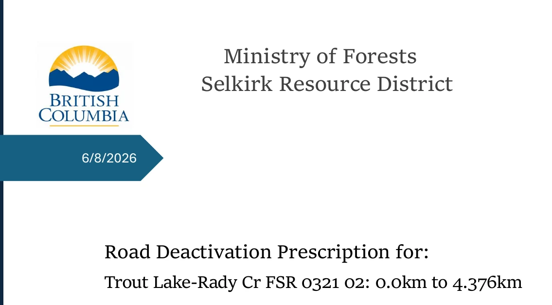
What it shows
Prepared by Jordan Pyette, RFT, Senior Engineering Technologist, Ministry of Forests. A Registered Forest Technologist — not an engineer, not a geoscientist. This is the document bidders were given, and the only prescription the ministry had when it put the removal of 4.4 kilometres of public road out to contract.
Its scope is worth holding in mind, because everything that follows is measured against it: 754 metres of fill pullback, 238 metres of recontouring, 61 cross ditches, across the full 4,376 metres. And among its four stated objectives, third on the list: “Reduce vehicle access due to safety concerns.”
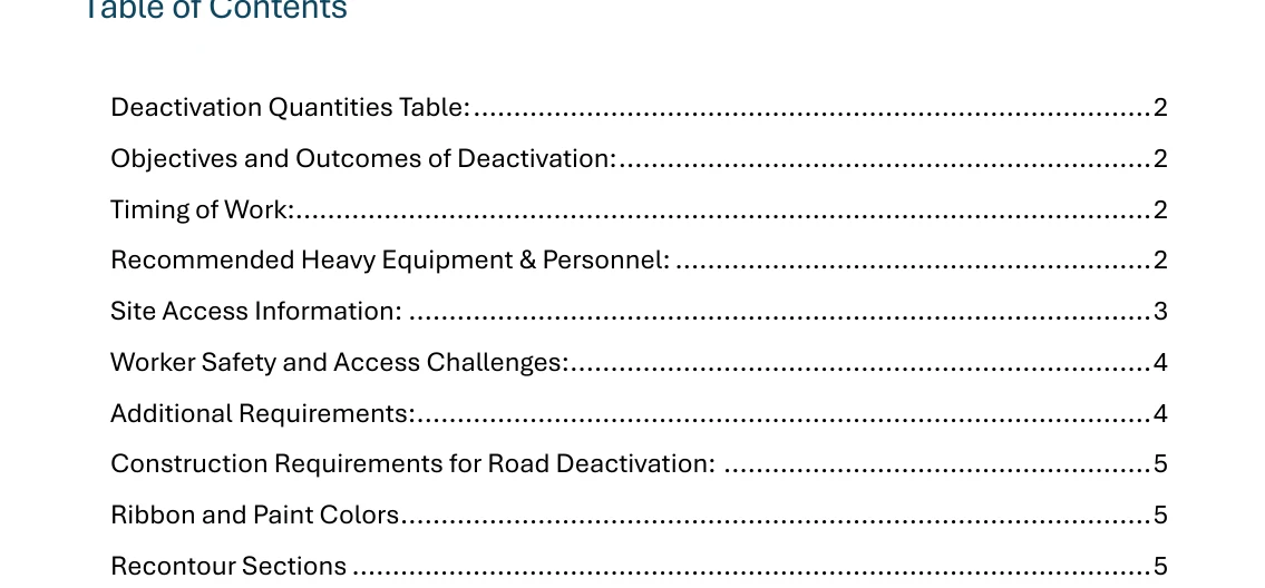
What it shows
Note what is not in the table: bridge removals, zero. Culvert removals, zero. The entire justification for destroying this road rests on slope stability — and on an objective, written into the ministry’s own document, of reducing public access.
Section 02The document that appeared on 18 September
On 17 September 2026 the tender was flagged in procurement tracking as having addenda available. The following day, at 18:50 GMT on 18 September, a new file appeared on the Selkirk district’s public road page: Trout Lake Rady-Creek FSR Deactivation Prescription and Map, 6.5 MB.03
It is not a revision of the June document. Set the two side by side and they share almost nothing; a line-by-line comparison puts them at 0.1 per cent similar. The thirteen-page in-house prescription has been replaced by a forty-two-page geotechnical report from an outside firm.
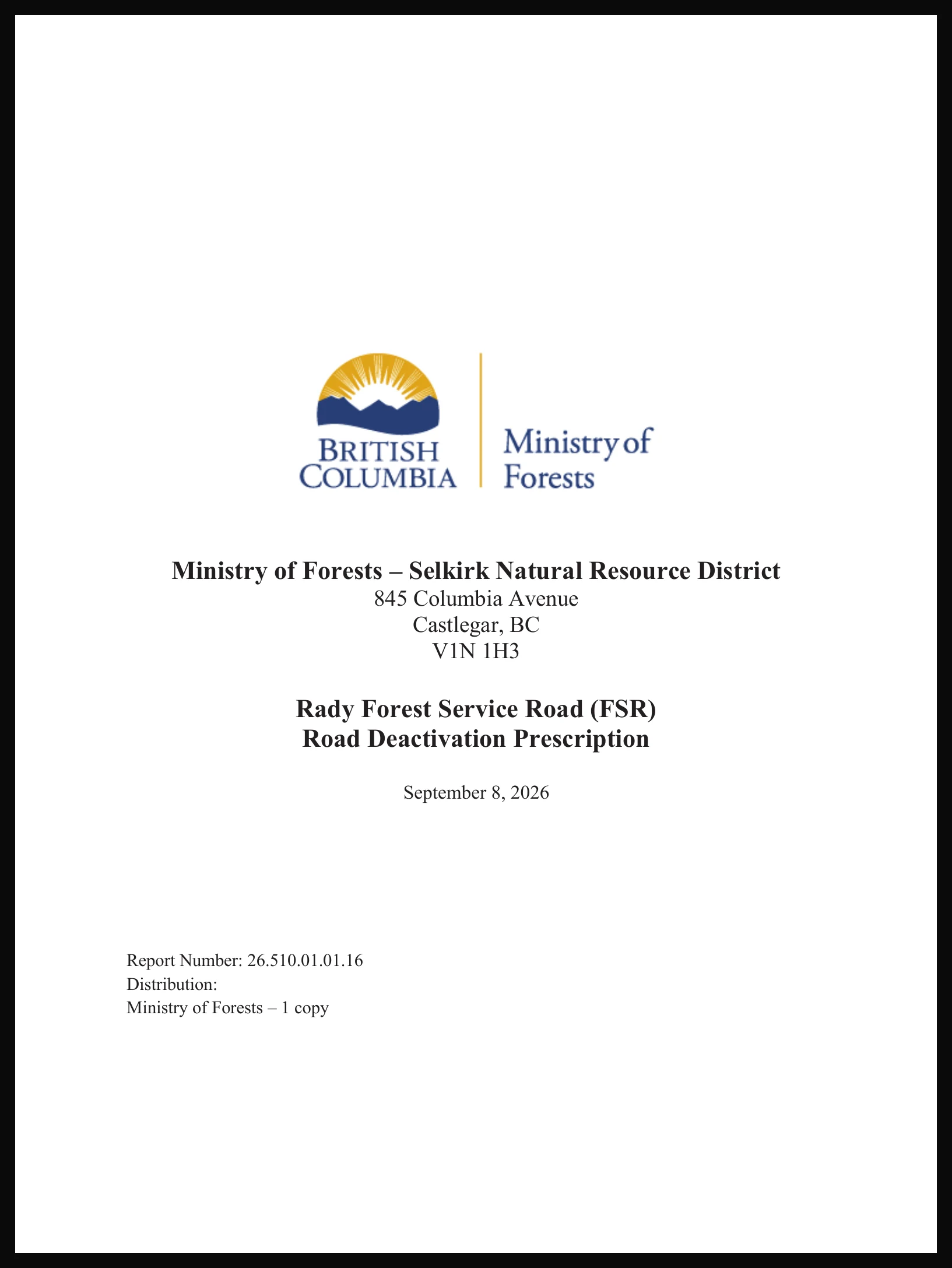
What it shows
Dated 8 September 2026. The PDF was created on the 9th. It reached the public on the 18th. The fieldwork behind it — a single walking traverse — was done on 18 August 2026, three weeks after the contract was already advertised.
The report says plainly why it exists. The Engineering Manual requires that a qualified registered professional “prepare, sign, and seal a prescription for road deactivation works and provide the results of the assessment in a letter or report that accompanies the deactivation prescription.” And then: “This report is intended to meet this requirement for the Rady FSR.”04
Read that as the admission it is. In September 2026, with a contract already on the street, the requirement had not yet been met.
Section 03The instruction that came before the assessment
Before the geoscientist walked the Rady Creek road, he was told what the answer was.
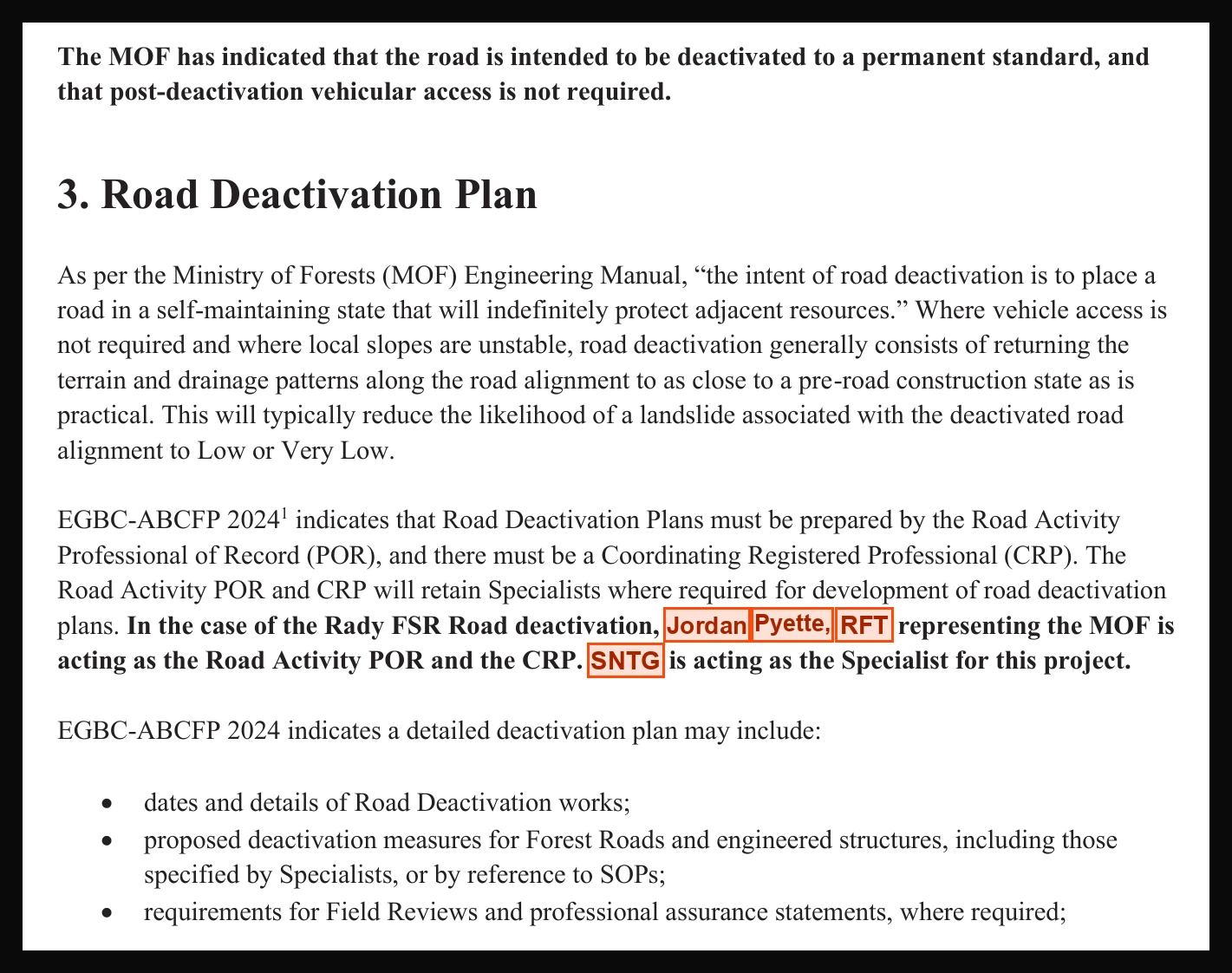
What it shows
“Post-deactivation vehicular access is not required.” The Ministry of Forests’ instruction — written into the brief before the assessment.
The orange is ours. Those names are blank in the published copy. Jordan Pyette, RFT carries the deactivation decision; SNTG only advises him.
Full return to a pre-road state needs two conditions: access not required and local slopes unstable. The ministry supplied the first.
He did not find it.
Section 04They paid for a second opinion. They got one.
Here is what happens when you finally let a qualified professional look at a road instead of asserting things about it for five years. He divides it into seven sections, walks each one, and writes down what each needs. Six of the seven come back with the same instruction.
“Leave the road prism intact.”
Not remove. Not recontour. Not rehabilitate to a permanent standard. Leave it. Put in cross ditches so water gets off it, pull back the over-steepened top metre or two of fillslope where it is loose, and leave the road where the road is. That is the prescription, for 3,865 of 3,980 metres.
2.9 per cent. That is how much of this road the Ministry’s own geoscientist prescribed destroying — one switchback at ∆17, where cutslope failures on the order of fifty cubic metres are present and the fill is up to fifteen metres long. The other 97.1 per cent he told them to leave where it is.
Set that drawing next to five years of public statements about an unsafe road that has to come out. The ministry did not need an independent professional to tell it the road was safe. It needed one to tell it the road was dangerous, and that is not what it got.
The trail they said was impossible
On the one switchback that does get recontoured, the report is blunt about the cost: “These works will result in loss of vehicle access along the alignment, including All Terrain Vehicle (ATV) access.” And then, in the very next sentence, it offers the thing the district has spent five years telling people cannot be done:
“It may be possible to cut a narrow ATV trail across the recontoured road surface at the time of deactivation works, however, the excess material generated from constructing the trail will need to be transported to a suitable waste site. This will result in an increased cost for the works above that of the prescribed recontouring.”
Read the objection. It is not that a trail would be unsafe. It is not that a trail would be unstable, or unlawful, or environmentally unacceptable, or technically impossible. It is that hauling the spoil away costs more money. That is the entire stated barrier to keeping public access across the 115 metres in dispute.
And the danger?
Once the prescribed works are done, the report rates residual landslide likelihood very low across most of the road, low at the switchback, and very low to low over the final 1,615 metres. It then declines to carry out a partial risk assessment at all, and says exactly why:
“this report does not include a partial risk assessment for the stated elements at risk due to a resultant low to very low residual hazard of a road related landslide once the deactivation recommendations in this report are implemented.”
The hazard is too low to be worth assessing. This is the document the district commissioned to prove the road is too dangerous to keep.
Section 05The regulation never required this either
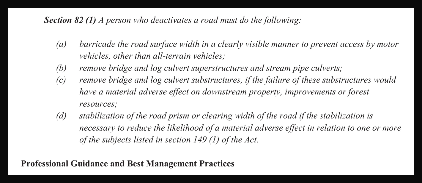
The report reproduces the law it is working under. Section 82(1) of the Forest Planning and Practices Regulation sets out what a person deactivating a road must do — and the first item contains a carve-out the ministry has never mentioned in five years of correspondence.
What it shows
The law says barricade the road “to prevent access by motor vehicles, other than all-terrain vehicles”. The regulation that governs deactivation expressly contemplates ATV access surviving it.
And on earthworks, clause (d): stabilization of the road prism “if the stabilization is necessary”. Necessary. Not preferred, not tidier, not cheaper to walk away from.
There are no bridges to pull on this road and no culverts to remove — the ministry’s own quantities table says zero of each. Strip out the parts of section 82 that do not apply and what the law asks for here is a barricade that lets ATVs through, and stabilization where stabilization is necessary. Which is, almost exactly, what the geoscientist prescribed.
Section 06Who is answerable
Four names carry this file. Three of them the district tried to hide; we will come to that in a moment. Here is who they are and what each one has to answer for.
Michael Ferguson, RFT
Ministry of Forests
Selkirk Natural Resource District
Commissioned the report
“At the request of Michael Ferguson, RFT… SNT Geotechnical Ltd. has completed a permanent road deactivation prescription for the Rady FSR.”
His question to answerWhy August 2026? The tender was already advertised. If a professional assessment was needed to justify this work, it was needed in 2021 — when the district first told the public an engineer had already done one.
Jordan Pyette, RFT
Senior Engineering Technologist
Ministry of Forests
Wrote the prescription that was replaced — and is still the professional of record
“Jordan Pyette, RFT representing the MOF is acting as the Road Activity Professional of Record and the Coordinating Registered Professional. SNTG is acting as the Specialist.”
What that arrangement meansThe outside geoscientist advises. The ministry technologist decides — the same one whose thirteen-page prescription was just thrown out, and who ran the 2025 inspection that rated the road high risk. This was never handed to an independent professional. An independent professional was hired to advise the man already holding it.
Ryan Williams, P.Geo.
SNT Geotechnical Ltd.
Nelson, BC
Walked the Rady Creek road, 18 August 2026
“Fieldwork consisted of a walking traverse of the road… Waypoints were collected at points of interest using a GPS-enabled phone.”
What he foundSix sections to leave intact, one to recontour, residual hazard low to very low throughout. He also tells the ministry to retain a qualified professional for a Danger Tree Assessment before works commence. There is no sign on the public record that this has happened.
Charlene Strelaeff
District Manager
Selkirk Forest District
The statutory decision-maker
Three days before this report was published, to a stakeholder: the ministry “will not consider transferring the road to another entity due to significant safety concerns… and will complete our deactivation work to relieve ourselves of liability.”06
Her question to answerHer own consultant rates the residual hazard low to very low once cross ditches go in. So on what professional basis does the district refuse to transfer 3,865 metres a geoscientist told it to leave exactly where they are?
Section 07They tried to redact it. The redaction did not hold.
So how hard was it? This is all it took.
The district did not send this to an FOI office. There is no cited exemption anywhere on the file and no severing note. Someone drew white rectangles over the names in a word processor, printed the result to PDF, and uploaded it to a government web server.
That is not redaction. That is taping over the words on a photocopy and handing you the original. A rectangle is a shape drawn on top of a page. It does not remove the text underneath. The words are still in the file — in order, selectable, exactly where they always were — and any program that reads a PDF hands them straight back to you.
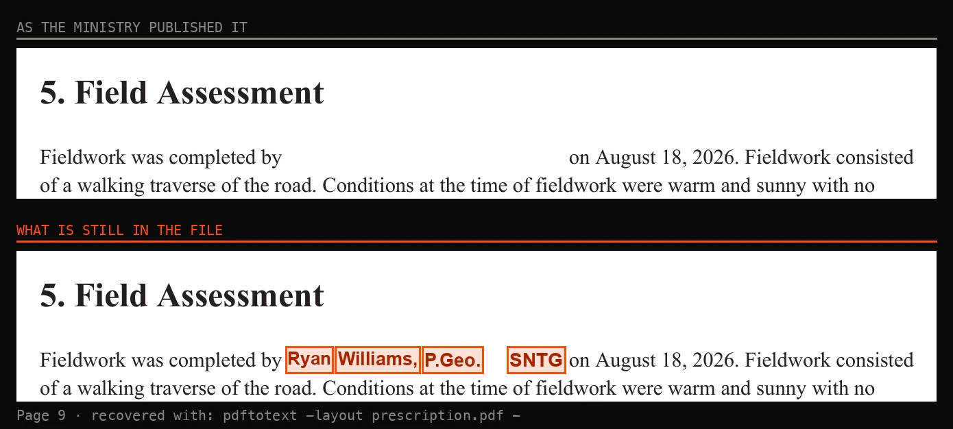
What it shows
Above, as published. Below, the same page with the file’s own words painted back into the gaps — nothing guessed. The second gap hides who is recommending a Danger Tree Assessment before works begin, which nothing on the public record shows has happened.
We ran it across all forty-two pages. Fourteen instances are covered, and all fourteen came back.05
| Painted out | Pages | Times |
|---|---|---|
| SNT Geotechnical Ltd. — the firm that wrote it | 1, 3 | 2 |
| SNTG — the same firm, short form | 2, 3, 5, 6, 7, 8, 9, 19 | 11 |
| Baker Street, Nelson — the firm’s address | 1 | 1 |
| Michael Ferguson, RFT — commissioned it | 3 | 1 |
| Jordan Pyette, RFT — professional of record | 5 | 1 |
| Ryan Williams, P.Geo. — walked the road | 9 | 1 |
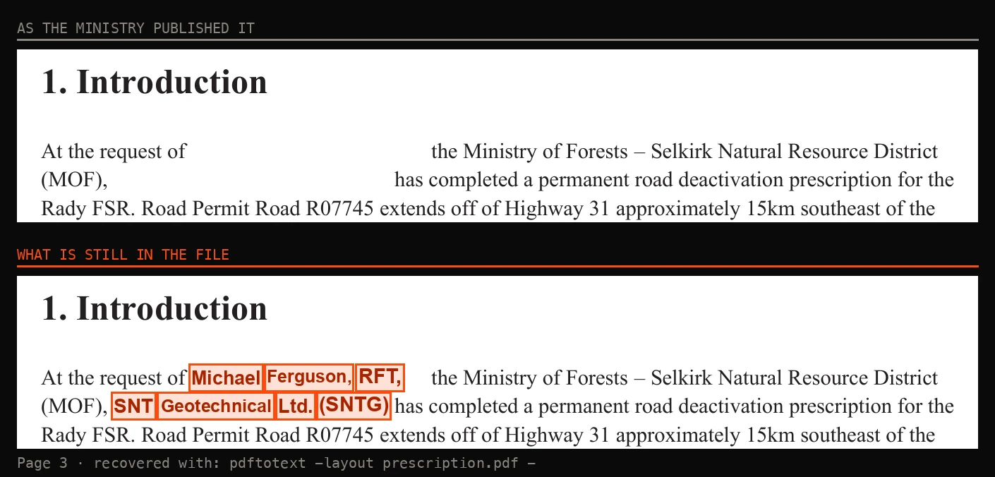
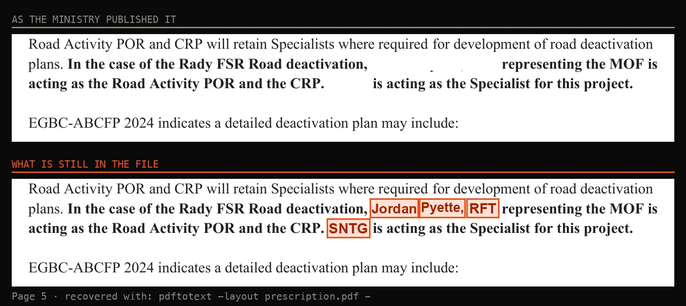
What it shows
The two sentences that establish accountability for the whole document — who ordered it, who wrote it, and which professional carries the decision — are the exact sentences the district blanked.
And they did not stop at the visible text. The file’s own document properties volunteer the rest:
- Title
- Deactivation Prescription.pdf
- Author
- Thomas Chalmers
- Created
- Microsoft® Word for Microsoft 365
- Converted
- Acrobat Distiller 26.0 (Windows) · 9 September 2026
Thomas Chalmers appears nowhere in the report. They covered the names in the body and left one in the metadata.
How we got this, start to finish. Download the file from the Ministry of Forests’ own public website. Run one command that ships with every Linux distribution. Read the names. About thirty seconds. No source, no leak, no freedom-of-information request, no tool anybody had to write:
pdftotext -layout prescription.pdf -
Child’s play. These guys make leaking their own internal records easier and easier every day.
So why redact it at all?
This is the part the district should be made to answer, because none of the available answers are good.
The entire point of the rule this report exists to satisfy is that a named professional stands behind it. The Engineering Manual does not ask for an assessment. It asks that a qualified registered professional “prepare, sign, and seal” one. A seal is a person putting their licence on the line. Publish the sealed document with the sealer’s name covered and you have deleted the only thing the requirement was created to produce — while still getting to say you published it.
So: who decided to blank the names of the professionals on a public safety document, and under what authority? No exemption is cited. There is no severing note. There is no FOI process in sight. And the blanking does not work — which means whoever did it either did not know that, or did not need it to. They needed the page to look redacted.
A district confident in its own file does not hide the name of the firm it hired, the address of that firm, the official who commissioned the work, or its own professional of record. It puts them on the cover, because they are the evidence the work was done properly. This district covered all four — in a report that tells it to leave 97 per cent of the road alone.
Section 08This is not a competent tender any more. It was changed mid-bid.
A tender is a promise about a job. Contractors read the scope, count the metres, price the plant and the crew, and sign. So read what this package actually promises. It tells bidders the works include “approximately 295m lineal meters of road fill pullback, 115m lineal meters of full pullback/recontouring and construction of at least 69 cross ditches”, and adds, flatly, “there are no culverts or bridges on this FSR.”07
Now compare that with the June prescription the package was issued with, the one the district spent five years standing behind: 754 metres of pullback, 238 metres of recontouring, 61 cross ditches.02 The package is not describing that job. Its pullback is well under half. Its recontouring figure — 115 metres — is the number that turns up in the September report’s own table, the report that did not exist in public until 18 September. The quantities the ministry put out to bid were never the June quantities.
And the package does not name a prescription. It tells bidders to “see ‘Schedule A – Services’, and the deactivation prescription for all works, personnel requirements and work location.” Which document that phrase points to changed on 18 September — six days before tenders closed at 1:00 pm on 24 September. No addendum was issued. So the governing engineering for a live contract was replaced inside the bidding window, and the document it was replaced with tells the reader to leave the road prism intact on six of seven sections.
The date question is worth settling, because the two documents do not agree. The June prescription says “deactivation works must be completed prior to October 2, 2026”.02 The contract a bidder actually signs says something else: “100% of the deactivation work must be completed by November 1st, 2026, or prior to snowfall accumulations of 10cm or more”, with a one-year option to renew if the job slips.08 November 1 is the operative deadline. But this road runs from 1500 to 2250 metres, and at that elevation 10 centimetres of snow is not a November event — it is a September one. The real deadline is not a date at all. It is the first storm.
Consider what a bidder is being asked to sign. The scope in the package does not match the prescription published with it. The prescription that now governs was swapped in mid-bid without notice. The engineering the contract rests on says to leave six of seven sections of the road exactly where they are. And the district published that engineering with the authors’ names covered — so a bidder could not have called them to ask what any of it meant even if he had thought to try.
The package is candid about one thing, at least. It states that the project “is contentious and well known to the public” and that the Ministry will provide “24/7 onsite security services for the entire duration of deactivation operations.” They budgeted round-the-clock guards to carry out a job their own consultant had just told them, on six of seven sections, not to do.
That is not a procurement process. That is a tender whose facts were changed underneath the people bidding on it. If a contractor did this to the Ministry — priced one scope, swapped the specification mid-bid and hid who wrote the drawings — the Ministry would disqualify him, and it would be right to.
Section 09There are two ways to read this, both point back at the Selkirk District’s conduct.
So: for five years this district could not produce the professional basis for destroying a public road. Then, with the contract advertised and bidders working, it obtained one. Either Mike Ferguson and the crew at the Selkirk district have finally done, in 2026, what they should have done in 2021 — or they have built a paper record around a decision they made years ago. They know which one it is. We are entitled to ask.
What is not in doubt is what the document says. Mike Ferguson asked for it — the report opens “At the request of Michael Ferguson, RFT” — and the brief his ministry handed the geoscientist said in advance that access was not required. What came back was a prescription that leaves the road prism intact over 97 per cent of its length, rates the residual hazard low to very low, and notes that even the one section requiring recontouring could carry an ATV trail for an additional cost.
That is not a justification for this contract. It is an argument against it, written by the ministry’s own consultant, published by the ministry itself, and filed under the heading of the very project it undermines.
Which rather suggests nobody read it before they failed to even properly redact it and uploaded it.
Pause EN27DSE008. Reconcile the contract with the prescription they paid for. And if they intend to dig past the 115 metres their own geoscientist prescribed, put it in writing and name the professional signing off on it.
The district had five years to get this right, and it spent them asserting instead of assessing. When the assertion finally had to meet a professional, the district replaced the document while the tender was open, and the replacement does not support the story it had already told — nor, on the record, did it read what it had bought.
Whatever the reason, the people responsible should have to explain it.
If you’re with CBC, CTV, or anyone else planning to check this rather than repeat it
Don’t take our word for any of it. The report is on the Ministry’s own website. The names came out of that file. And the firm that wrote it is not hard to reach — the Nelson address the district painted out is published on the firm’s own contact page.
- Firm
- SNT Geotechnical Ltd. · sntg.ca
- Nelson
- Suite #4 – 385 Baker Street, Nelson BC V1L 4H6 · 250-814-9737
- Kamloops
- Suite 202 – 925 McMaster Way, Kamloops BC V2C 6K2 · 250-299-5142
- admin@sntg.ca
Three questions worth putting to them
- Were you told, before the assessment began, that post-deactivation vehicular access was not required?
- Did you prescribe recontouring anywhere other than the 115 metres at ∆16–∆18?
- Were you asked, or told, that your name would be removed from the published copy?
SNT Geotechnical has not been accused of anything here. They were hired, they walked the road, and they wrote what they found. It is the district’s handling of their report that this piece is about.
Share this story
Six images carrying this story on their own — the document, the date and the name behind each one. Made to be posted.



Slide 1 of 6
Suggested caption
@rparmarbc’s Ministry of Forests just bought a report to justify killing the Rady Creek road. We removed the redactions in about thirty seconds — and what we found shows the Selkirk District has been telling the public things its own records do not support, for at least five years.
On six of seven sections their own geoscientist wrote the same instruction: leave the road prism intact.
For five years the district told the public that an engineer had condemned this road, and for five years it could not produce any evidence. Then, with bidders already pricing the job, a 42-page report nobody announced appeared on a government website on 18 September and replaced the entire justification.
The answer was decided before the assessment began. Page 4 records that the Ministry “has indicated that the road is intended to be deactivated to a permanent standard, and that post-deactivation vehicular access is not required.” That is not an assessment, it is an order with a letterhead on it.
On the one switchback that does raise concern, the report says a narrow ATV trail can be cut across the recontoured surface. The objection is not safety and it is not stability, it is that hauling the material away would cost more.
Then they published that report with fourteen names redacted across nine pages: the firm they hired, that firm’s address, the official who ordered it, and their own professional of record.
We did not get those names from a leak, from a source, or from a freedom-of-information request. The rectangles were drawn on top of the page and the text was still sitting underneath, so any program that reads a PDF hands them straight back.
Read the fully unredacted prescription and what it means for Rady…
backcountry.cx/editorials/the-prescription-they-did-not-want/
#BCpoli #PublicLand #RadyCreek #Kootenays #FOI
Sources
- ↩↩Tara DeCourcy, RPF, District Manager, Selkirk Natural Resource District, to Jeanine Ross, Trout Lake Recreational Club, 9 November 2021: “I believe the recommendations were made on site and there was no subsequent report,” and, in the same exchange, “I don’t think a specific report was completed, just the prescription that I sent you.” The three credentials previously given for the same unnamed reviewer — a professional engineer, a geotechnical engineer and a professional geoscientist — are set out with their sources in It was never the caribou.
- ↩↩↩Road Deactivation Prescription for: Trout Lake-Rady Cr FSR 0321 02: 0.0km to 4.376km, Ministry of Forests, Selkirk Resource District, dated 6/8/2026, 13 pages, prepared by Jordan Pyette, RFT, Senior Engineering Technologist. Issued as part of the bid package for invitation to tender EN27DSE008, BC Bid opportunity 233877. The Deactivation Quantities Table records road fill pullback (3–6 m reach) 754 m, recontouring 238 m, 3 swales, 2 waterbars, 61 cross ditches, bridge removals 0, culvert removals 0, total FSR length to deactivate 4,376 m. Objective 3 reads “Reduce vehicle access due to safety concerns.” Timing: “Deactivation works must be completed prior to October 2, 2026.” Held on file.
- ↩Province of British Columbia, Selkirk Natural Resource District road safety information. Under Road deactivations, the entry for Trout Lake Rady-Creek FSR 0321.02 (13 November 2025) now carries a link headed “Trout Lake Rady-Creek FSR Deactivation Prescription and Map (PDF, 6.5MB).” The file is served at /assets/…/selkirk/trout_lake_rady_creek_deactivation_prescription_map.pdf and returns an HTTP Last-Modified header of Fri, 18 Sep 2026 18:50:00 GMT. The tender was flagged in procurement tracking as carrying addenda on 17 September 2026; we have not read the addendum itself, and the connection between it and this file rests on those dates rather than on the addendum’s text. https://www2.gov.bc.ca/gov/content/industry/natural-resource-use/resource-roads/local-road-safety-information/selkirk-natural-resource-district-road-safety-information
- ↩Rady Forest Service Road (FSR) Road Deactivation Prescription, SNT Geotechnical Ltd., Suite #4, 385 Baker Street, Nelson, report number 26.510.01.01.16, dated 8 September 2026, 42 pages, prepared for the Ministry of Forests – Selkirk Natural Resource District, Castlegar. PDF creation date 9 September 2026. Quoted here: section 1 on the commissioning by Michael Ferguson, RFT, and on the Engineering Manual requirement that a qualified registered professional “prepare, sign, and seal a prescription… This report is intended to meet this requirement for the Rady FSR”; section 2 reproducing FPPR sections 37 and 82(1); the passage “The MOF has indicated that the road is intended to be deactivated to a permanent standard, and that post-deactivation vehicular access is not required”; section 3 on Jordan Pyette, RFT as Road Activity Professional of Record and Coordinating Registered Professional with SNTG as Specialist, citing Professional Services in the Forest Sector – Forest Roads, EGBC-ABCFP, version 2.0, October 2024; section 4 on residual hazard and the omission of a partial risk assessment; section 5 on the 18 August 2026 walking traverse and the Danger Tree Assessment recommendation; and section 6 with Table 2, the section-by-section prescription. Section lengths as printed: ∆1–16, 800 m; ∆16–18, 115 m; ∆18–26, 430 m; ∆26–35, 540 m; ∆35–41, 185 m; ∆41–45, 295 m; ∆45–71, 1,615 m — 3,980 m in total. Every section but ∆16–18 carries the instruction “Leave the road prism intact.” Published by the Province at the address in source 3. The Province publishes this report itself, as “Trout Lake Rady-Creek FSR Deactivation Prescription and Map”, on the Selkirk district road safety page. https://www2.gov.bc.ca/assets/gov/farming-natural-resources-and-industry/natural-resource-use/resource-roads/local-road-safety-information/selkirk/trout_lake_rady_creek_deactivation_prescription_map.pdf
- ↩The redactions in the published copy are visual only — white rectangles drawn over text that remains in the file. Fourteen instances across nine pages: SNT Geotechnical Ltd. (pp. 1, 3), SNTG (pp. 2, 3, 5, 6, 7, 8, 9, 19), the firm’s Baker Street address (p. 1), Michael Ferguson, RFT (p. 3), Jordan Pyette, RFT (p. 5) and Ryan Williams, P.Geo. (p. 9). On page 9 the rendered text reads “Fieldwork was completed by” followed by a blank; extracting the text layer of the same file with pdftotext returns “Ryan Williams, P.Geo. of SNTG” in that position. The exhibits in this piece were produced by rendering the published page at 200 dpi and drawing each recovered word back at the coordinates pdftotext -bbox reports for it; no text was reconstructed or inferred. Page numbers throughout this piece are PDF page positions, which is what pdftotext -f takes; the report’s own printed folios run one lower. File properties as published: Title “Deactivation Prescription.pdf”, Author “Thomas Chalmers”, Creator “Microsoft® Word for Microsoft 365”, Producer “Acrobat Distiller 26.0 (Windows)”, creation date 9 September 2026. The same pattern was recorded in the copy issued to bidders and is documented on saverady.com. https://saverady.com/
- ↩↩Charlene Strelaeff, District Manager, Selkirk Forest District, to the BC Snowmobile Federation, 15 September 2026, file 285993: “The Ministry of Forests will not consider transferring the road to another entity due to significant safety concerns and environmental concerns and will complete our deactivation work to relieve ourselves of liability. Once the road is deactivated and has been closed and discontinued, it will become vacant crown land. It will then be available for someone to make an application for a Licence of Occupation under the Land Act.” Copied to MLA Brittny Anderson and to the Regional Executive Director, Kootenay Boundary. Held on file.
- ↩Province of British Columbia, Ministry of Forests, Invitation to Tender EN27DSE008 — Trout Lake Rady-Cr FSR 0321.02 Road Deactivation, BC Bid opportunity 233877, tender package. Closing: “local time, September 24, 2026, at which time all tenders will be opened in private.” Scope: “Approximately 295m lineal meters of road fill pullback, 115m lineal meters of full pullback/recontouring and construction of at least 69 cross ditches. There are no culverts or bridges on this FSR.” Length requiring deactivation 4.4 km; elevation range 1500–2250 m. Timing: “The deactivation must be completed by November 1st, 2026, or prior to snowfall accumulations of 10cm’s.” Also: “This deactivation project is contentious and well known to the public. The Ministry of Forests will provide 24/7 onsite security services for the entire duration of deactivation operations.” Bidders are directed to “See ‘Schedule A – Services’, and the deactivation prescription for all works, personnel requirements and work location.” Held on file.
- ↩Province of British Columbia, Ministry of Forests, EN27DSE008 — Specimen Contract, issued with the tender package. Under “Timing and Completion of Work”: “100% of the deactivation work must be completed by November 1st, 2026, or prior to snowfall accumulations of 10cm or more. This FSR is located at high elevation (1500m to 2250m) and deactivation is scheduled to occur outside the Migratory bird nesting and breeding season, and when the high elevation sites are snow free. A one-year option to renew clause is included in this contract in the event that an unforeseen circumstance results in a delay of completing this project in 2026.” Held on file.